NISAR Satellite Set to Revolutionize Earth Monitoring in 2025
NISAR, which stands for NASA-ISRO Synthetic Aperture Radar, is designed to monitor nearly all of Earth’s land and ice surfaces every 12 days, the SciTechDaily reported.
It will track changes in ecosystems, land, and sea ice, and the solid Earth. The satellite is scheduled to lift off from the Satish Dhawan Space Centre, located on India’s southeastern coast.
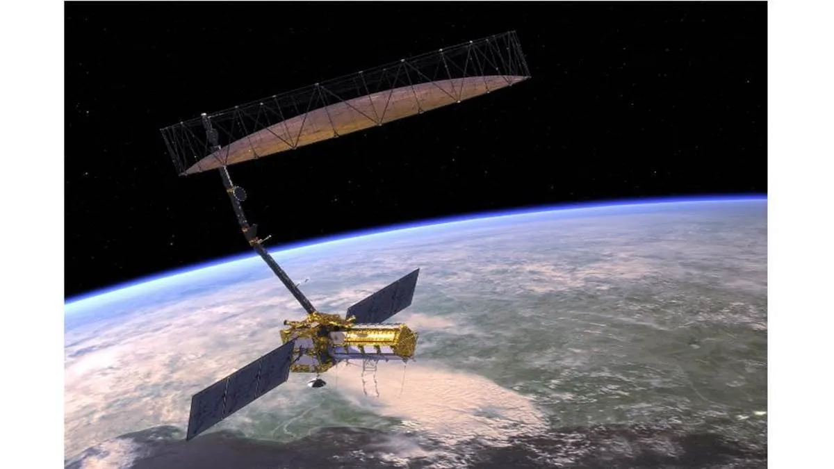
The NASA-ISRO Synthetic Aperture Radar (NISAR) mission is a groundbreaking collaboration between NASA and the Indian Space Research Organisation (ISRO) designed to monitor and better understand changes on Earth’s surface. Scheduled for launch in March 2025 from the Satish Dhawan Space Centre in India, NISAR will use advanced radar imaging to provide detailed and reliable data about Earth’s ecosystems, ice masses, and geological processes.
Equipped with a sophisticated dual-frequency radar system, NISAR will scan nearly all of Earth’s land and ice surfaces every 12 days. The mission aims to track changes in vegetation, measure ice sheet dynamics, monitor natural hazards like earthquakes and landslides, and study long-term shifts in the planet’s structure and climate. By observing these changes at unprecedented resolution, NISAR will play a crucial role in improving environmental management and disaster response, while also advancing our understanding of the complex interactions shaping Earth’s systems.
The satellite represents a significant technological and scientific partnership between NASA and ISRO. It combines NASA’s expertise in space observation with ISRO’s advanced radar technology, highlighting the power of international collaboration in addressing global challenges.
4155/v


