Iranian Researchers Make High-Quality Rescue Radar Device
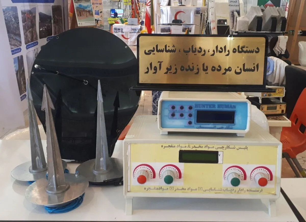
“This device, which is made by using bio-electro resonance technology, is used to detect and search dead people and survivors in critical situations. It enjoys the capability to detect the living and dead people under debris or underground through frequency detection,” Seyed Ali Hosseini, the managing director of the knowledge-based company, told ANA.
He explained that the device can find the human body under a heavy object, including debris by detecting the frequency, adding that in critical situations, the device is able to send a frequency of 2,500 Hz underground and cover up to a depth of 50 meters underground.
Noting that the device also enjoys the capability to detect the area and extent of the damage, Hosseini said, “After detecting whether a person is alive or dead, the device scans three-dimensional images of the person's body and all images are sent to the user with a warning on the digital radar screen which is highly important in the treatment process.”
“The advantage of this device, which is unique in the world, is the high quality of images recorded by it thanks to its capability to penetrate into a depth of 50 meters and more,” he said.
Also, in October, Iranian researchers had designed the first polarimetric radar imaging system for the analysis of faults to prepare for possible unexpected incidents like earthquake.
“We succeeded in designing and building the SAR polarimetric imaging system,” Ahmad Soleimani, a commercialization expert of the Iranian Space Research Center, told ANA.
“SAR polarimetric system is a type of radar that can be mounted on mobile platforms of airplanes and drones, and this system extracts color images from the target area by forming simultaneous images in different polarizations and provides more complete information than the gray images of single-polarization SAR systems,” he added.
“SAR polarimetric system enjoys the capability to take images at all hours of the day and night and in any weather conditions and can be mounted on airplanes and drones,” Soleimani said.
“This system is used for the classification and monitoring of agricultural products, seismology and faults, geology and mine exploration, management of unexpected incidents like earthquakes, droughts, floods, storms, etc., oceanographic studies, urban traffic management and control, identification of environmental pollution, pasture studies, forestry and mapping,” he added.
4155/v


