Radar Imaging System Developed in Iran for Analysis of Faults
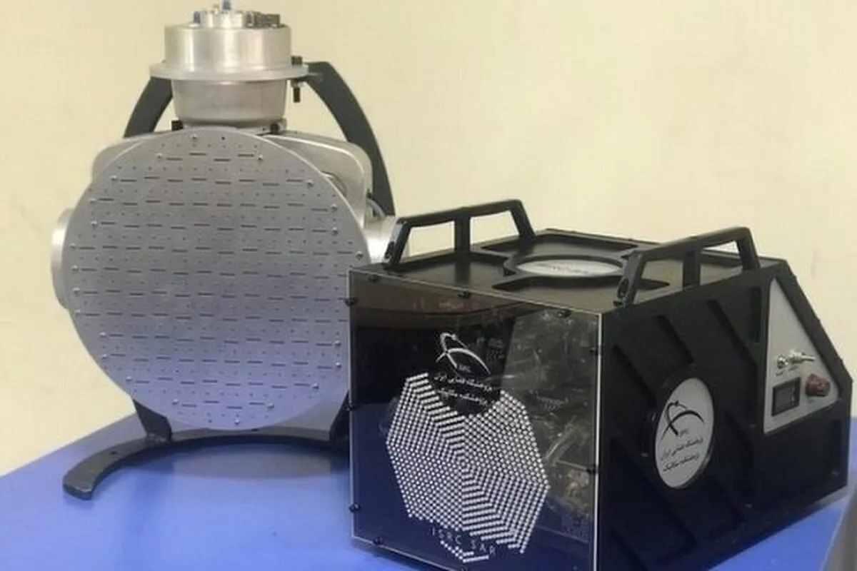
“We succeeded in designing and building the SAR polarimetric imaging system,” Ahmad Soleimani, a commercialization expert of the Iranian Space Research Center, told ANA.
“SAR polarimetric system is a type of radar that can be mounted on mobile platforms of airplanes and drones, and this system extracts color images from the target area by forming simultaneous images in different polarizations and provides more complete information than the gray images of single-polarization SAR systems,” he added.
“SAR polarimetric system enjoys the capability to take images at all hours of the day and night and in any weather conditions and can be mounted on airplanes and drones,” Soleimani said.
“This system is used for the classification and monitoring of agricultural products, seismology and faults, geology and mine exploration, management of unexpected incidents like earthquakes, droughts, floods, storms, etc., oceanographic studies, urban traffic management and control, identification of environmental pollution, pasture studies, forestry and mapping,” he added.
Earlier, in January, Iranian researchers at the faculty of Mapping and Geospatial Information Engineering of University of Tehran had succeeded in designing and making Ground Based Synthetic Aperture Radar (GBSAR) with high penetrating power and ability to be used at any hour of the day and night.
“At present, this radar is undergoing laboratory testing in the form of student theses at the master's and doctoral level and it will be used in the real environment after checking its capabilities,” said Jalal Amini, a professor of the faculty of Mapping and Geospatial Information Engineering of the University of Tehran, who has succeeded in designing and making this radar with the help of graduate students of the University of Tehran.
“In microwave remote sensing, microwave bands of the electromagnetic spectrum are used, and among the capabilities of these waves is their permeability into ground, as well as the possibility of using them in any weather conditions and 24 hours a day while the optical remote sensing devices do not enjoy such capabilities,” he added.
Amini said that this type of ground radar sensor can be applied in detection of ancient monuments, the movements of existing bridges in urban areas, residential towers and subway stations, the auto-making industry to identify the amount of movement or deformation of each car part and even in medicine for assessing the heart rate and the amount of displacement and movement of the chest.
4155/v


