Ancient Oceanic Plate Rips Apart beneath Iraq, Iran
A team of international researchers, led by the University of Göttingen, has studied how the forces exerted by the Zagros Mountains in the Kurdistan region of Iraq have influenced the bending of the Earth’s surface over the past 20 million years, the journal Solid Earth reported.
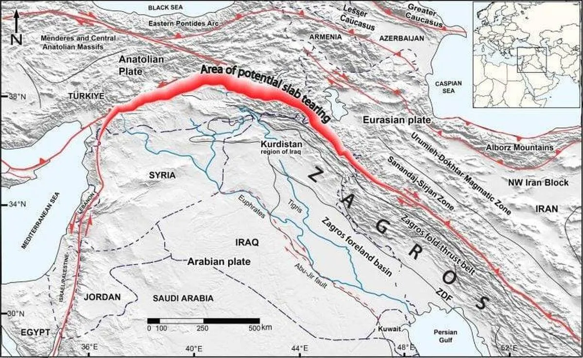
Their findings reveal that, deep beneath the Earth’s surface, the Neotethys oceanic plate—once the seafloor between the Arabian and Eurasian continents—is currently breaking off in a horizontal direction. This rupture is gradually extending from southeast Turkey to northwest Iran. The study highlights how deep-seated geological processes within the Earth’s interior shape the planet’s surface. The research was published in Solid Earth.
When two continents converge over millions of years, the oceanic floor between them slides to great depths beneath the continents. Eventually, the continents collide, and masses of rock from their edges are lifted up into towering mountain ranges.
Over millions of years, the immense weight of these mountains causes the Earth’s surface around them to bend downward. Over time, sediments eroded from the mountains accumulate in this depression, forming plains such as Mesopotamia in the Middle East. The researchers modeled the downward bend of the Earth’s surfaces based on the Zagros Mountain’s load where the Arabian continent is colliding with Eurasia.
They combined the resulting size of the depression with the computed topography based on the Earth’s mantle to reproduce the unusually deep depression in the southeastern segment of the study area. The researchers found that the weight of the mountains alone cannot account for the 3-4 km deep depression that has formed and been filled with sediment over the past 15 million years.
“Given the moderate topography in the north-western Zagros area, it was surprising to find out that so much sediment has accumulated in the part of the area we studied. This means the depression of the land is greater than could be caused by the load of the Zagros Mountains,” said Dr. Renas Koshnaw, lead author and Postdoctoral Researcher at Göttingen University’s Department of Structural Geology and Geothermics.
Researchers propose that this is caused by the additional load of the sinking oceanic plate that is still attached to the Arabian plate. Koshnaw adds: “This plate is pulling the region downward from below, making space for more sediment accumulation. Towards Turkey, the sediment-filled depression becomes much shallower, suggesting that the slab has broken off in this area, relieving the downward pull force.”
The geodynamic model developed in this research will benefit other fields as well. “This research contributes to understanding how the Earth’s rigid outer shell functions,” explains Koshnaw. Such research can lead to practical applications in the future by providing information for exploring natural resources such as sedimentary ore deposits and geothermal energy, and better characterization of the earthquake risks.
4155/v


