China uses AI to map Earth’s deep mantle
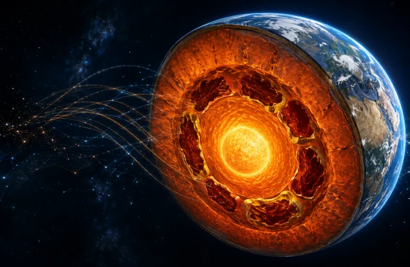
Deep beneath Earth’s surface, at a depth of nearly 2,900 kilometers, the mantle gives way to the liquid outer core. The dynamics of these extreme depths influence tectonic plate movements and contribute to earthquakes and volcanic eruptions. Yet directly studying these regions is impossible.
In a new study published in the Journal of Geophysical Research: Solid Earth, researchers from the Chinese Academy of Sciences used artificial intelligence algorithms to probe Earth’s interior to depths far beyond the reach of mechanical drilling.
Seismic waves as a scanning tool
The geophysicists analyzed a 35-year archive of seismic data collected between 1990 and 2024. Scientists typically search earthquake recordings manually for faint signals known as PKP wave precursors.
These waves scatter when they encounter small, heterogeneous structures near the boundary between the mantle and the core, returning to Earth’s surface shortly before the arrival of stronger primary waves. Identifying such subtle structures manually across millions of seismic recordings is extremely time-consuming.
AI accelerates the search
To speed up the process, the researchers trained a deep-learning system to rank seismic records by quality and analyze more than two million seismograms generated by around 5,000 earthquakes.
The researchers manually checked and corrected errors made by the neural network, then fed the corrected examples back into the model to improve its performance.
Ultimately, the AI system identified 174,929 high-quality weak signals, roughly ten times the total number detected by previous studies.
The new dataset has changed geologists’ understanding of Earth’s lower mantle. Instead of showing isolated and seemingly random anomalies, earlier maps are now complemented by evidence that these regions are connected, forming extensive and interconnected belts.
The origin of these thermochemical clusters may date back billions of years. Scientists suggest they could be remnants of oceanic crust dragged deep into Earth by tectonic processes. Another hypothesis is that they may consist of fragments of Theia, the protoplanet believed to have collided with Earth billions of years ago, contributing to the formation of the Moon.
Under immense pressure and extreme temperatures, these materials may have partially melted or undergone changes in their physical properties.
The new map also identified six previously undocumented anomalous regions, including areas beneath higher latitudes of Eurasia, Central Asia and the South Atlantic.